An AI analysis of satellite images reveals fishing, shipping and offshore development activities worldwide by monitoring boats that don’t publicly broadcast their location
By Jeremy Hsu
3 January 2024
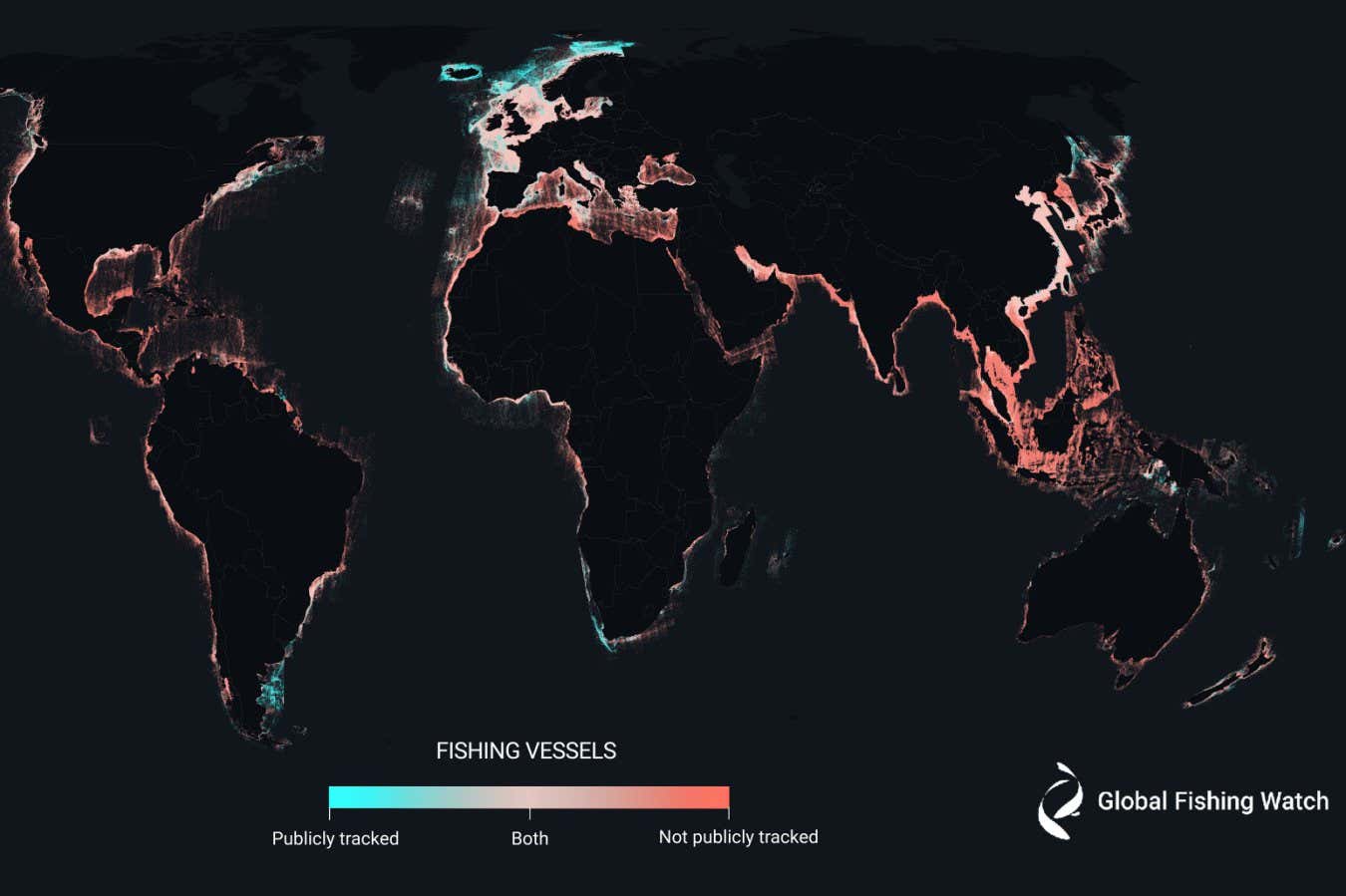
The majority of the world’s industrial fishing vessels are not publicly tracked
2023 Global Fishing Watch
Three-quarters of the world’s large fishing boats and a quarter of transport and energy ships are “dark vessels” that do not publicly share their location. The finding comes from an analysis of satellite images using artificial intelligence – an approach that could help better track human activities impacting the oceans.
“We had an idea that we were missing a big chunk of the activity happening in the ocean but we didn’t know how much,” says Fernando Paolo at Global Fishing Watch, a non-profit organisation based in Washington DC. “And we found that it’s a lot more than we imagined.”
Read more
Shipwrecks are havens for wildlife in areas threatened by fishing
Advertisement
Paolo and his colleagues used satellite images – including radar images that can reveal objects regardless of clouds or darkness – taken between 2017 and 2021 and covering coastal regions where most large-scale fishing and other industrial activities take place. The researchers trained several AIs to detect and categorise boats and offshore structures within this dataset.
By comparing this global map of vessels with a database of boats that publicly broadcast their location, the researchers found the majority were not keeping their automated identification systems on. Such identification is not always required but the lack of its use may indicate illegal fishing and other activities.
One AI learned to identify fishing vessels from other types of boats according to travel patterns and locations. It found that between 42 and 49 per cent of the approximately 63,000 vessels fit this classification.